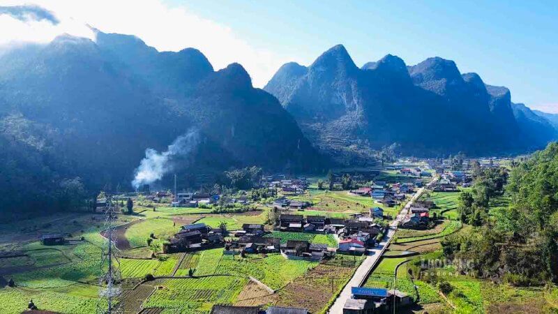
Tay Con Linh is a mountain of over 2,400 m in Ha Giang, often called “the Roof of Northeast Vietnam”. It is a serious trek through ancient forest and changing weather, reached via Hoang Su Phi and Nam Ty commune, in the land of the Dao and Hmong people. The best time to go is the dry season from October to April, and you should go with a local guide because the trails are not well marked.
Tay Con Linh at a glance

Why visit Tay Con Linh
Unspoiled nature
Ancient forest, wild orchids and bamboo at over 2,400 m, with clear air and big skies.
A real trek
Rugged trails and changing weather make the summit a serious adventure, with views to match.
Dao and Hmong culture
Villages like Nam Ty and Ban Luoc are a chance to learn about herbal medicine, embroidery and mountain life.
The Dao people consider Tay Con Linh a sacred mountain. Wrapped in fog and legend, it feels peaceful and powerful.

Best time to visit Tay Con Linh
Good time to trek
- October to April: dry, clear skies
- March to April: flowers and birdlife in the forest
Avoid
- May to September: rainy season
- Slippery and dangerous trails

How to get to Tay Con Linh
Hanoi to Ha Giang City
- TransportSleeper bus
- TimeAbout 7–8 hours
Ha Giang City to Nam Ty
- RouteTo Hoang Su Phi district, then Nam Ty commune, the gateway to the mountain
The trek
- GuideGo with a local guide or trekking tour, routes are not well marked and pass through dense forest and steep terrain

Tips for trekking Tay Con Linh
Gear
- Hiking boots and a raincoat
- Headlamp and warm layers
Supplies
- Snacks and water
- A power bank, there is no signal or shops on the mountain
Respect
Ask before taking photos, hire local guides, and stay in a homestay in Nam Ty or Ban Luoc for local meals and hospitality.
Frequently asked questions
How high is Tay Con Linh?
Over 2,400 m, one of the highest peaks in northeast Vietnam.
Where is Tay Con Linh?
In Ha Giang, reached via Hoang Su Phi district and Nam Ty commune.
Do I need a guide?
Yes. Trails are not well marked and pass through dense forest and steep terrain.
When is the best time to trek?
October to April, in the dry season.
Where can I stay?
In homestays in Nam Ty and Ban Luoc villages.
More of Ha Giang with Zgo Travel
- Most popular · from $116Ha Giang Loop 3-Day small group
- More time · from $139Ha Giang Loop 4-Day small group
- Short on time · from $109Ha Giang Loop 2-Day small group
Want to explore Ha Giang?
Our Ha Giang Loop tours cover Dong Van, Ma Pi Leng and Meo Vac. Ask us on WhatsApp about your plans.